Project Story
Fort William Walking and Cycling Network
Location
Fort William, Scotland
Highland and Islands Transport Partnership (HITRANS)
Highland Council
Partners
Date
Aug. 25, Aug. 26
Area
25 km walking & cycling network
Promoting active travel with a physical and digital wayfinding system
The goal of this project is to make it easier for people living in and visiting Fort William to make short journeys by walking, wheeling or cycling, through a colour-coded wayfinding system and journey planner
Expertise
-
Update of the 2019 Active Travel Masterplan and what infrastructure is available today.
Newly defined Active Travel network using existing infrastructure and low traffic streets.
-
Captured detailed network data with 360° imagery.
Identified opportunities for improvement.
Level of safety of the network graded using Cycling by Design.
-
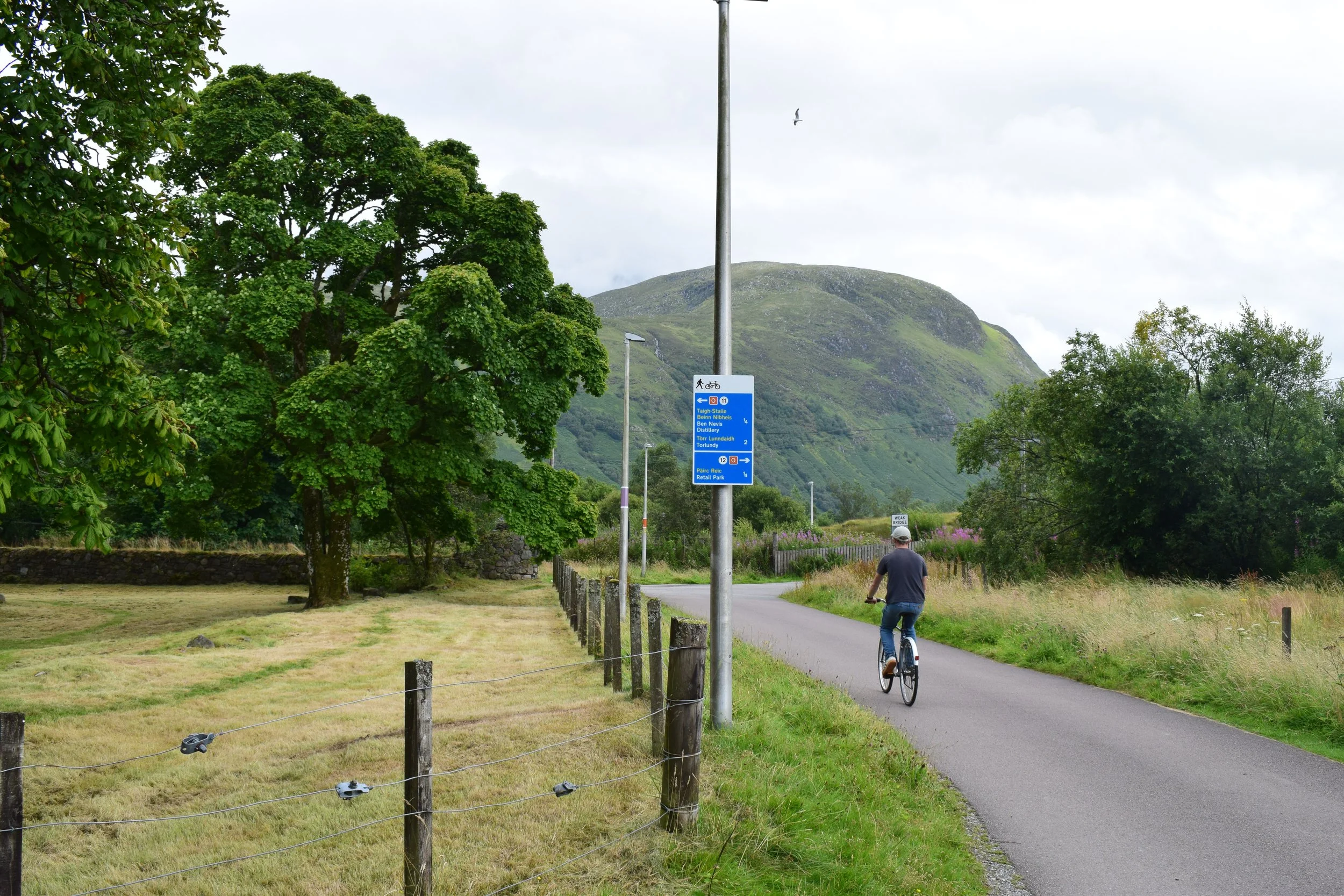
Designed and implemented colour-coded signage and wayfinding on the network.
-
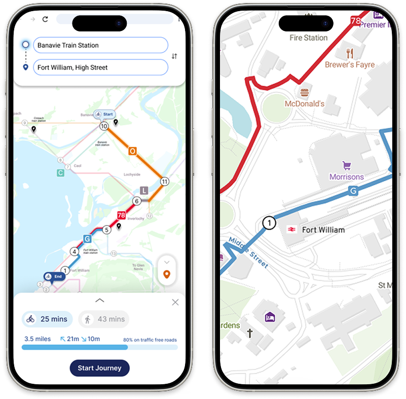
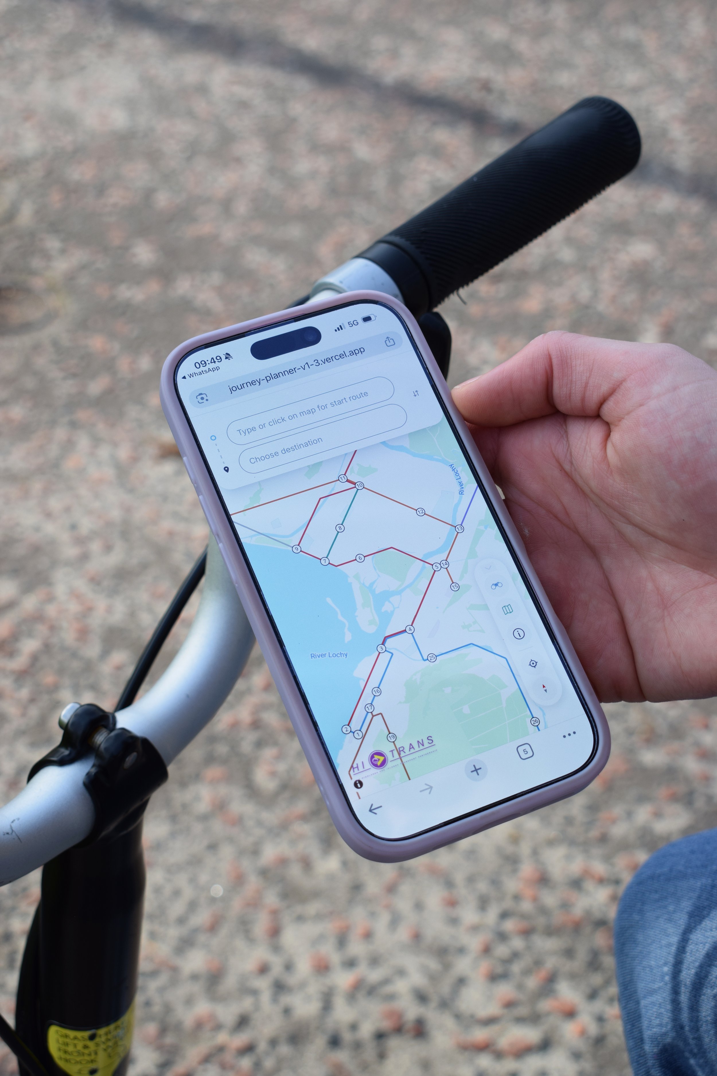
Developped a journey planner to enable people to see where the network is, plan a journey and give feedback.
Provided leaflets and maps to display in local shops and key hubs.
Wayfinding
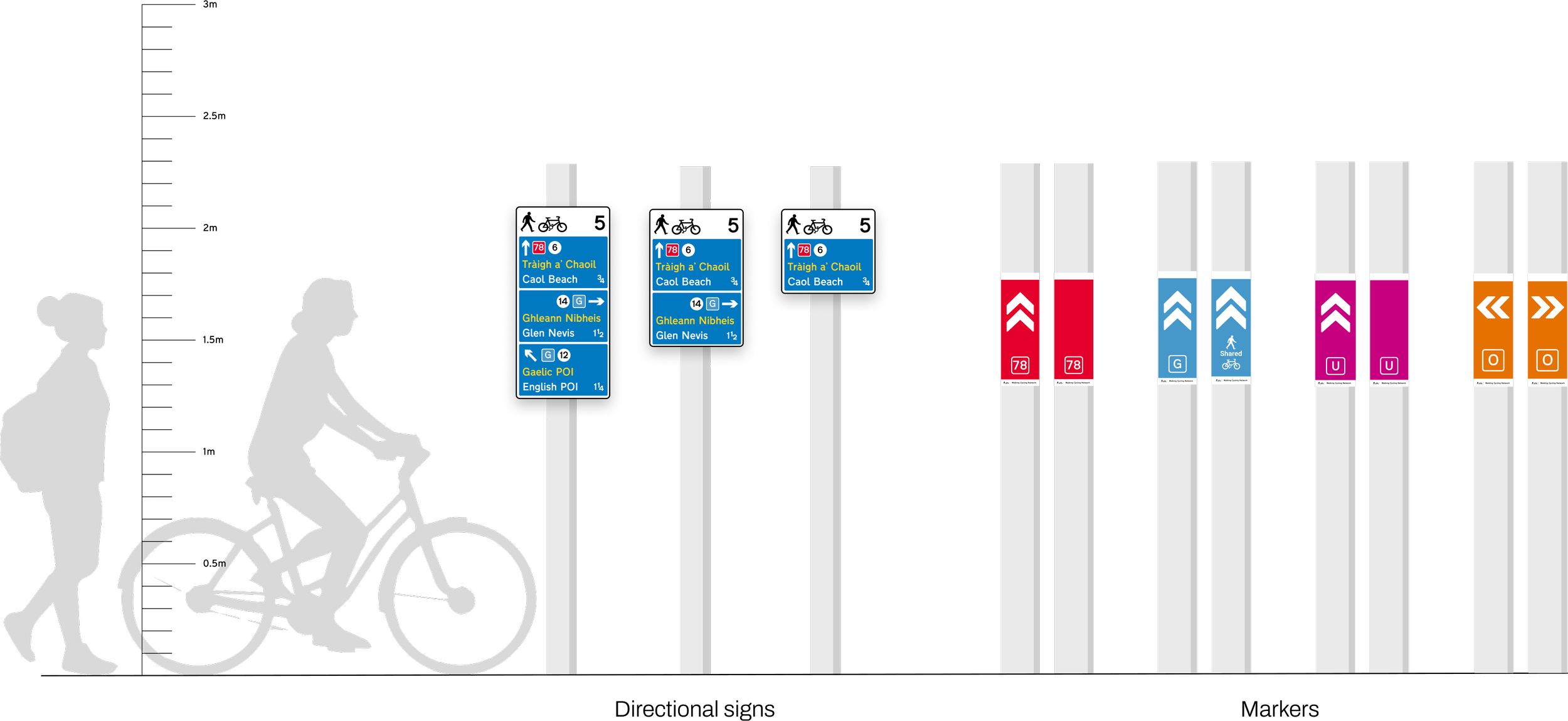
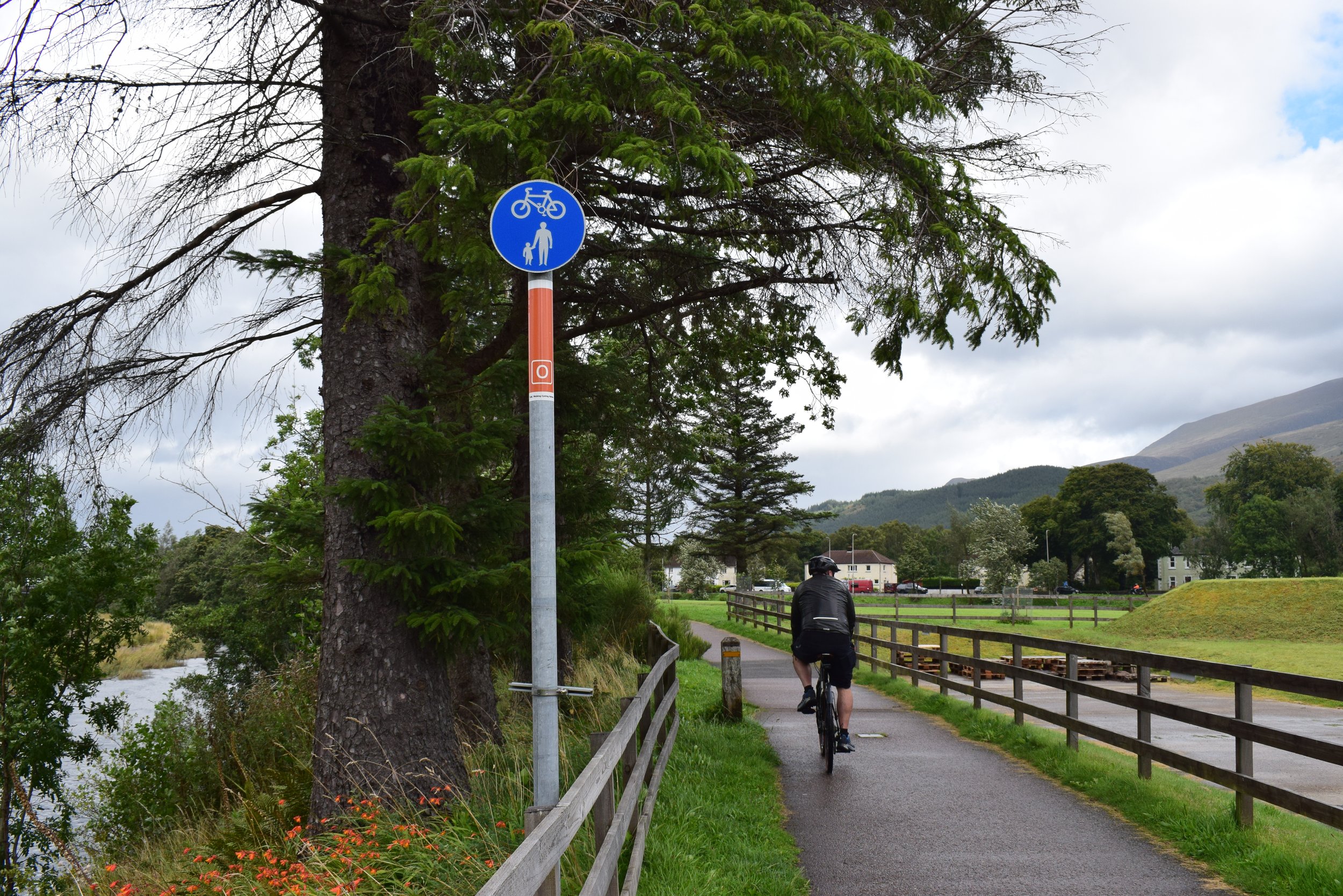
The system is made of directional signs providing information at key intersections (nodes) and of markers giving reassurance along the route. 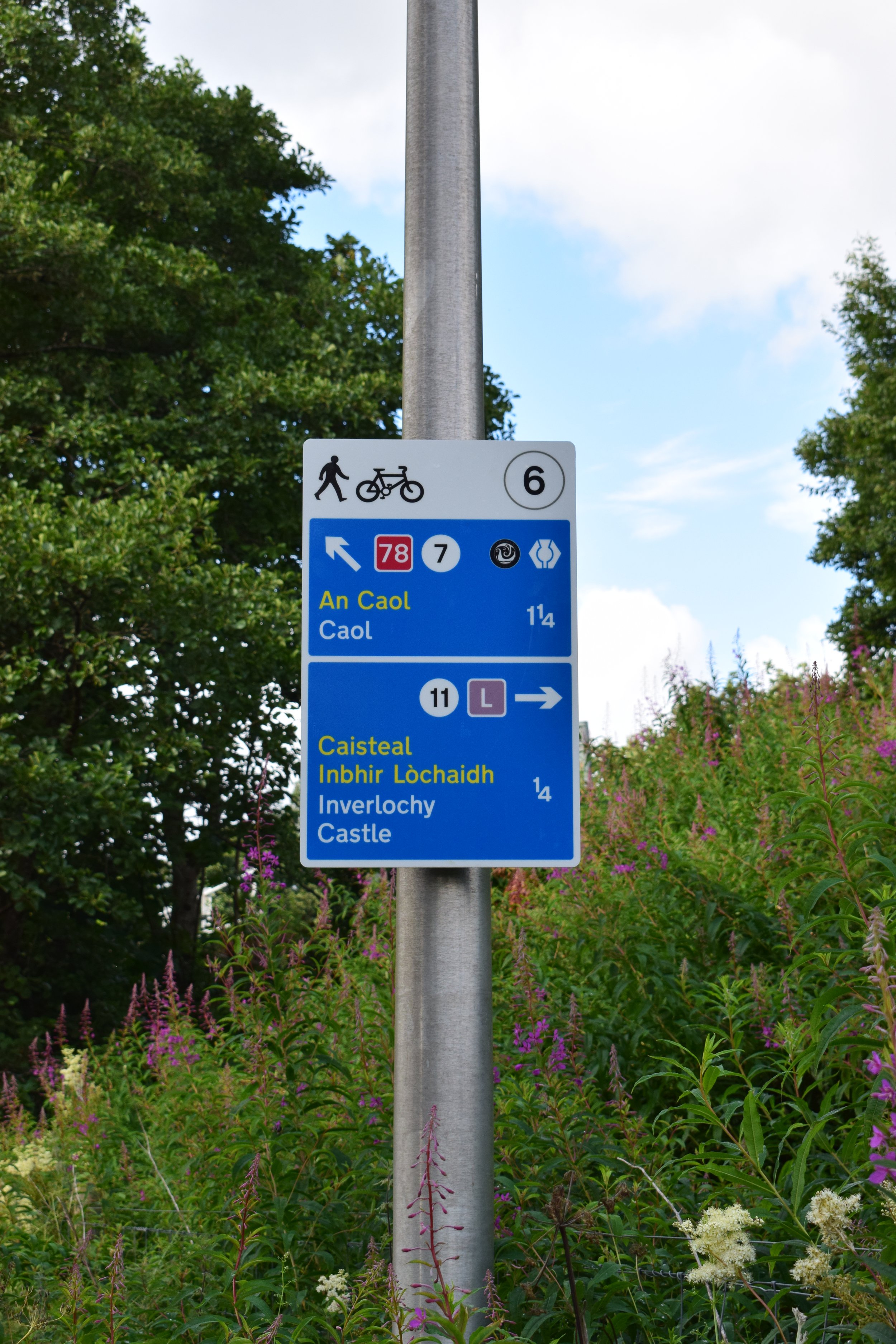
Journey Planner
An interactive interface enabling to know where you are on the network, where you can go and to plan a journey.